Total Pageviews

Sunday, May 6, 2012

Cinco De Bike-o

I know I know! It makes no sense when you translate it. But it sounds funny and this is ONLY a bike blog.  So who cares? Anyways, after I got off of work at six in the morning I wasn't ready to sleep yet. So I decided to get in another ride on the Fox River Trail. Headed North from Carpentersville towards Algonquin.  In a past posting I was talking about a bridge over a creek in the Algonquin area of the FRT bike trail and how that bridge was out for repairs. Well, they had removed the whole dang bridge, as my pictures had attested to.  The signs had said the bridge was going to be inaccessible until May 5.  When I got to the area the signs were still up and the barriers as well. I thought I might as well go take a look for myself to determine the current conditions. The picture captions are numbered but not in order. I am too lazy and short on time to fix it right now. Heh.
1)That lite spot ahead is the location of the bridge.

4)A look up the trail from the center of the bridge.

2)Much closer to the bridge now.

3)Entering the new structure from the South.


And then I decided to lengthen my bike trip now that I have established that the bridge is useable again. I am going to head North to Lake In The Hills to see if I can see the site of that small plane crash that happened yesterday. Also, the new pedestrian/bike bridge over that nasty intersection of Pyott and Three Oaks Road should be nearing completion and is right next to the LITH Airport.
Riding North on the FRT. LITH Airport on left side of pic. Gravel pit on right where I THINK that small plane crashed. But no signs of it there now.

Looking across the street from the FRT at the LITH Airport.

Looking South on the FRT at Pyott rd. and the LITH Airport.

More looking South on the FRT.

More looking North on the FRT.
In that last pic, if you look hard, you can make out an old grain silo. That is where the new section of trail will open and go around the nasty busy intersection of Pyott and Three Oaks Roads and over a new bridge.
Left old trail leading to nasty intersection. Right new trail with new bridge.

Looking East up the new trail.

Looking North up the old trail.

On the new section of trail looking North at the new bridge.

Looking NorthEast from new trail section.

On new section of trail looking West towards old section of trail.

Looking directly North uphill towards new bridge.

New bridge construction not complete yet! Bummer.

A closer look at the forms.

Forms and corrugated galvanized steel on bridge.

Looking down and NorthWest at nasty intersection.

Looking parallel with West side of bridge.

On the bridge.

Good sturdy bridge! 20000 lbs!

Looking parallel with East side of bridge.

Looking down and East at Three Oaks Road.

Looking back South at my bike and the new trail.

Looking SouthEast at gravel pit from new bridge.
Alas, the new bridge is not done yet. I think I will continue North for a few more shots of the bridge and then into Crystal Lake to finish half of the ride.
On MCPP looking North towards the nasty intersection.

Entry gates at nasty intersection.

Just past the entry gates at the nasty intersection.

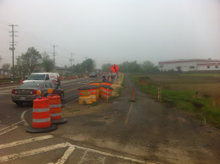
Construction everywhere.

Waiting for cars to pass in order to cross.

Looking East at the new bridge.

New lanes being added under new bridge.

And the old trail keeps heading North.

Looking South at the nasty intersection.

On the MCPP looking South at the nasty intersection.

Where the old and new paths merge.


Looking South where the two paths merge.

Looking South at the beginning of the new construction.

McHenry County Conservation District trail sign.

The Rules

Monday, April 16, 2012

A Few Weekend Rides

I thought I would try to get in a Saturday night ride down the Fox River Trail. but I was stopped by the line of nasty storms that stretched all the way across the country and was responsible for all those tornados. I watched the radar and finally got in an early dawn ride up the trail from Carpentersville to Algonquin.
Not sure where I took this picture.
I made my way across the Fox River bridge and then over the Rte 62 bridge to find that the construction, or rather the deconstruction and reconstruction of a bridge over a creek just a quarter mile North of Rte 62 is only about half done. Here is what I saw.
Trail Closed

Trail Closed


The new pilings for the bridge.
That creek is pretty swollen.
A few weeks ago we were able to navigate that creek via a few well placed planks and a bit of good balance. All the planks have been since removed and the new foundations for the bridge put in place.
On the way back I stopped at a few bridges to get a few pics of the swollen creeks.


Looking West up the Fox River Trail from the bridge over the Fox River.
Looking East over the Fox River bridge on the FRT

Me and the bike on the bridge.

My bike and all the casing for my phone is sitting next to it.

  I had to take all the protective Otterbox casing off of my phone in order to get the reverse shot with me and the bike in the frame. I got in about 10.5 miles that day.  Today I rode the same trail just before dawn in order to try out my lights on the bike. 56F and overcast. Got in 10.9 miles.
This is from the opposite side of the under construction bridge looking North.
A week ago I was able to ford the creek via planks. The above picture is from the North bank of that creek. That was on my regular mountain bike. This weekend was on my hybrid folding Swissbike TX.