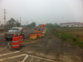
 |
| 1)That lite spot ahead is the location of the bridge. |
 |
| 4)A look up the trail from the center of the bridge. |
 |
| 2)Much closer to the bridge now. |
 |
| 3)Entering the new structure from the South. |
And then I decided to lengthen my bike trip now that I have established that the bridge is useable again. I am going to head North to Lake In The Hills to see if I can see the site of that small plane crash that happened yesterday. Also, the new pedestrian/bike bridge over that nasty intersection of Pyott and Three Oaks Road should be nearing completion and is right next to the LITH Airport.
 |
| Riding North on the FRT. LITH Airport on left side of pic. Gravel pit on right where I THINK that small plane crashed. But no signs of it there now. |
 |
| Looking across the street from the FRT at the LITH Airport. |
 |
| Looking South on the FRT at Pyott rd. and the LITH Airport. |
 |
| More looking South on the FRT. |
 |
| More looking North on the FRT. |
 |
| Left old trail leading to nasty intersection. Right new trail with new bridge. |
 |
| Looking East up the new trail. |
 |
| Looking North up the old trail. |
 |
| On the new section of trail looking North at the new bridge. |
 |
| Looking NorthEast from new trail section. |
 |
| On new section of trail looking West towards old section of trail. |
 |
| Looking directly North uphill towards new bridge. |
 |
| New bridge construction not complete yet! Bummer. |
 |
| A closer look at the forms. |
 |
| Forms and corrugated galvanized steel on bridge. |
 |
| Looking down and NorthWest at nasty intersection. |
 |
| Looking parallel with West side of bridge. |
 |
| On the bridge. |
 |
| Good sturdy bridge! 20000 lbs! |
 |
| Looking parallel with East side of bridge. |
 |
| Looking down and East at Three Oaks Road. |
 |
| Looking back South at my bike and the new trail. |
 |
| Looking SouthEast at gravel pit from new bridge. |
 |
| On MCPP looking North towards the nasty intersection. |
 |
| Entry gates at nasty intersection. |
 |
| Just past the entry gates at the nasty intersection. |
 |
| Construction everywhere. |
 |
| Waiting for cars to pass in order to cross. |
 |
| Looking East at the new bridge. |
 |
| New lanes being added under new bridge. |
 |
| And the old trail keeps heading North. |
 |
| Looking South at the nasty intersection. |
 |
| On the MCPP looking South at the nasty intersection. |
 | |
| Where the old and new paths merge. |
 |
| Looking South where the two paths merge. |
 |
| Looking South at the beginning of the new construction. |
 |
| McHenry County Conservation District trail sign. |
 |
| The Rules |
Nice photos! I bike this same portion of the FRT frequently. If you see an orange ElliptiGO on the trail it's me. It's surprising you ride so many miles with all stops you make to take photos!
ReplyDeleteI will keep an eye out for you when I ride that section of trail!
ReplyDelete